
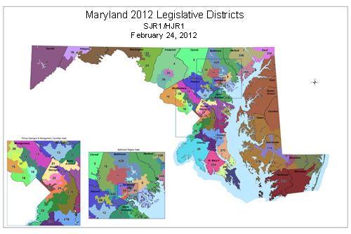
Maryland’s Current Legislative District Plan
Is it ever too early to discuss the next cycle of redistricting?
The first elections for this decade’s plan are just being held this year since the 2010 elections occurred prior to the decennial redistricting wrangling.
But here at Seventh State, it’s never too early to look ahead, so I’ve taken a peek at the Maryland Department of Planning’s current population estimates for 2020. These estimates can only be taken as a rough basis not just because they’re estimates but because Maryland reallocates prisoners back to their home address for redistricting purposes.
Maryland has been at the forefront of addressing prison-based gerrymandering. The location of a large prison artificially boosts the population of an area even though none of its residents can vote. In Maryland, the allocation of prisoners from prisons in rural areas, such as from the three prisons in Allegany County, just happens to benefit Baltimore City.
Long the center of political power in Maryland, Baltimore City’s representation has declined rapidly in recent decades. The addition of prisoners from the City back into its population for redistricting purposes helps slow its steady loss of seats in the General Assembly.
Having mentioned these very large caveats regarding the reliability of the population estimates, here is what a look at the projected populations suggests for representation in the General Assembly in 2022:
Baltimore City will drop to five legislative districts. The City will gain people over the decade but at a slower pace than the rest of the State. Not enough to staunch the loss of political power. In other words, the new Baltimore City delegation will continue the City’s never ending game of political musical chairs, despite its mighty efforts not to cede representation.
In contrast, Frederick will gain enough population to incorporate the rest of District 4–its second district.
Montgomery will deserve more representation (roughly one-half of one delegate) but will remain close enough to eight districts that the number probably will remain unchanged. The big question is whether Rockville and Gaithersburg will be too large to stay together in one district. The law prohibits unnecessary violations of municipal boundaries, so this could necessitate redrawing the County’s whole map.
Prince George’s will lose roughly 40% of a delegate–almost exactly the share that neighboring Charles will gain.
While Calvert will see little change, St. Mary’s will come very close to no longer having to share a district with another county.
Howard should gain roughly 50% of a delegate–very close to the share than next door Baltimore County will lose.
Western Maryland (Garrett, Allegany and Washington) will retain its two districts with few changes.
Very little change for the nine counties on the Eastern Shore (Caroline, Cecil, Kent, Queen Anne’s Talbot, Dorchester, Somerset, Wicomico, Worcester).
Surprisingly, the numbers also project little change for the Baltimore exurbs of Carroll and Harford.
Remember that State law constrains the drawing of districts that violate too many county and municipal boundaries, except to satisfy the requirements of the federal Voting Rights Act. This limit will prevent any attempt to save Baltimore City’s political weight by drawing pizza pie districts out into the County that remain dominated by the City. The State tried this tactic during the 2000 round but the map was overturned in court.
Of course, these are really just guesstimates at this point. But it’s fun to peek ahead to Maryland’s political future.
