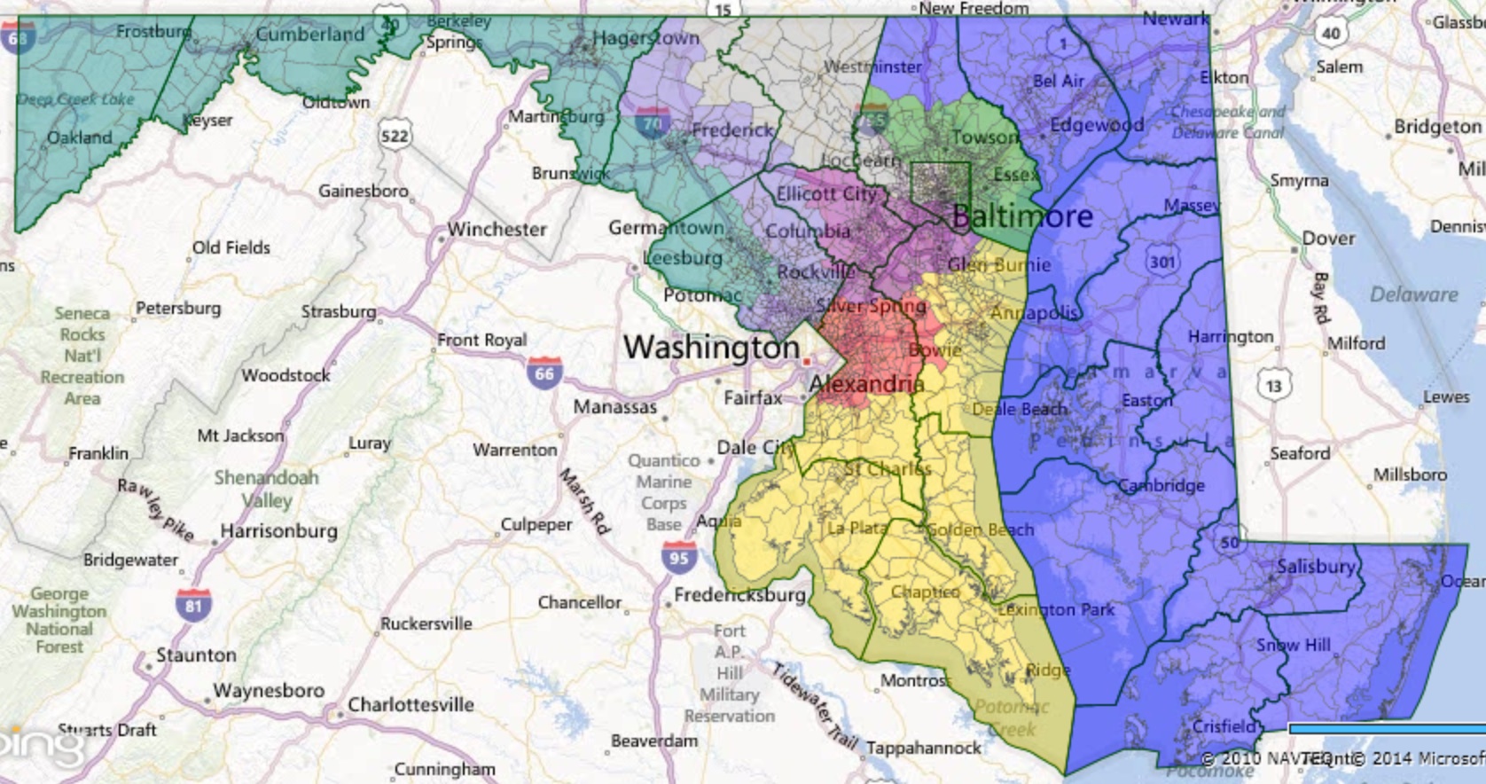
Much has been made of the, ahem, “creative” boundaries of Maryland’s current congressional districts. A previous post provided more detailed maps that show the true artistry of the districts. But here is a statewide view that probably doesn’t do it full justice:
 Maryland’s Current Congressional District Map
Many cite the non-compact boundaries as evidence of partisanship. Certainly, the 6th District was reconfigured to aid Democrats, who picked up the seat in 2012. However, Democrats did not have to draw these non-compact districts to gain a 7-1 majority in place of the previous 6-2 split. The following plan has seven districts that Obama won by 15% or more in 2008:
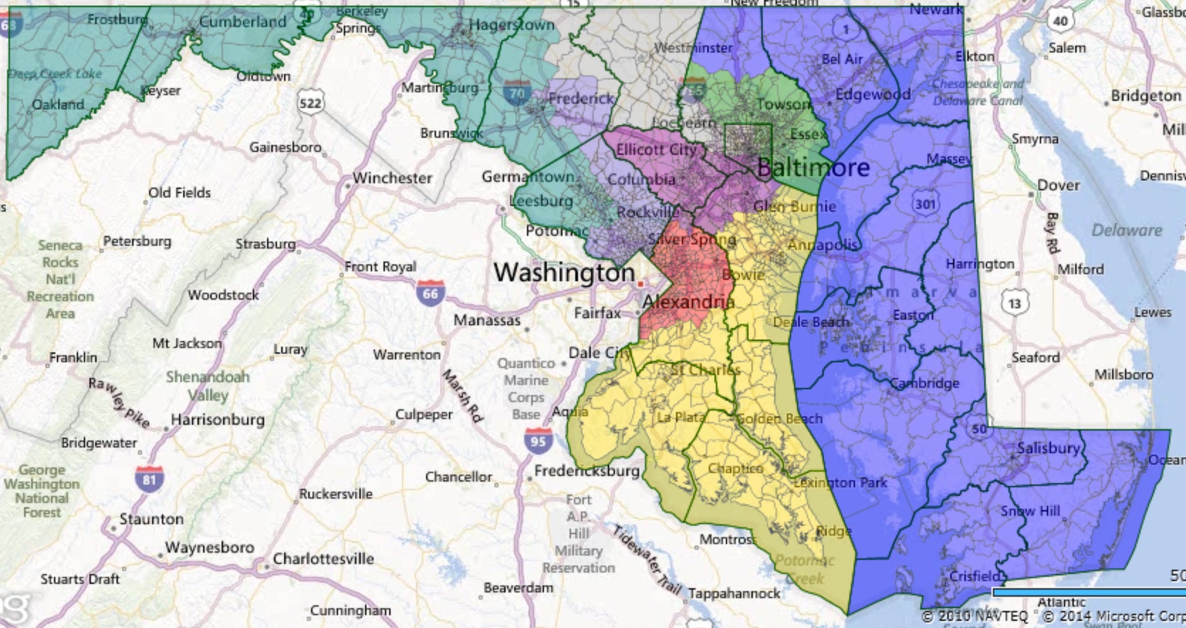
 Alternative Congressional Plan 1
While probably not the most compact plan that could be drawn, it also is clearly much more compact than the enacted plan. Beyond containing seven very Democratic districts, it also still contains two districts that are over 50% black in voting-age population.
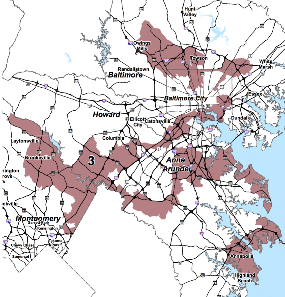
A map that gave Democrats at least a 10% advantage in seven districts, again as measured by support for Obama in 2008, could be made even more compact and violate fewer county boundaries:
 Alternative Congressional District Plan 2
In this version, District 8 doesn’t reach the Pennsylvania border or take in any portion of Carroll County, which is no longer split. The Fourth District is also entirely within Prince George’s. Montgomery County has only two districts instead of three.
So why did the Democrats choose to adopt a plan with such meandering districts instead of a simpler version? According to many different sources, the answer lies in the desire to favor the preferences of certain incumbents, even when they were highly idiosyncratic and would not alter their reelection chances.
(1) Rep. Steny Hoyer insisted on continuing to represent UMD College Park, which he has represented since entering Congress. (Love the Turtle!) However, College Park is at the northwestern end of Prince George’s. Accommodating the desires of this powerful representative forced many other changes to plan.
For example, the 4th couldn’t continue to go into Montgomery if the 6th was to take in significant portions of that County, so the 4th now crawls around the edge of Prince George’s to enable it to scoop up Republican voters in Anne Arundel.
(2) Similarly, Rep. Dutch Ruppersberger sits on the intelligence committee and wanted to represent both Fort Meade and the Aberdeen Proving Ground. (Couldn’t we just buy him his own spy cam?) Even more creativity ensued as these two facilities lies at the opposite ends of the Baltimore region
(3) Rep. Elijah Cummings did not want to represent Carroll County, throwing yet another complication into the mix. Carroll is very Republican but would have easily been swamped by Cummings’ Baltimore base. So now Rep. Chris Van Hollen represents parts of Carroll County.
(4) Rep. John Sarbanes felt strongly that he wanted to continue to represent Annapolis, adding another layer of complexity into the plan’s requirements. Drafting a plan to satisfied this demand along with Ruppersberger’s helps explain how the 2nd and 3rd districts took on even more convoluted shapes.
(5) Complicating it all further was that so several representatives–Cummings, Harris, Ruppersberger, and Sarbanes–live with a small area near Baltimore. While living in the district is not required–just ask John Delaney–most prefer to do it.
And that’s how we ended up with this:
By the way, there is no legal impediment to gerrymandering for incumbents. Indeed, courts have cited it as a legitimate rationale for states to craft plans in a particular manner.
